


Industrial Way Voting District, Cowlitz County, Washington
About
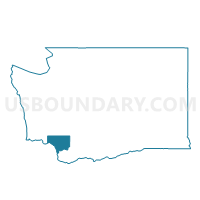
Outline

Summary
| Unique Area Identifier | 684053 |
| Name | Industrial Way Voting District |
| County | Cowlitz County |
| State | Washington |
| Area (square miles) | 16.65 |
| Land Area (square miles) | 9.97 |
| Water Area (square miles) | 6.68 |
| % of Land Area | 59.90 |
| % of Water Area | 40.10 |
| Latitude of the Internal Point | 46.12969940 |
| Longtitude of the Internal Point | -122.98340800 |
Maps


Graphs
Select a template below for downloading or customizing gragh for Industrial Way Voting District, Cowlitz County, Washington


Neighbors
Neighoring Voting District (by Name) Neighboring Voting District on the Map
- Alabama North Voting District, Cowlitz County, WA
- California Way Voting District, Cowlitz County, WA
- Carrolls South Voting District, Cowlitz County, WA
- Coal Creek Voting District, Cowlitz County, WA
- Constitution Voting District, Cowlitz County, WA
- Fir Voting District, Cowlitz County, WA
- Memorial Voting District, Cowlitz County, WA
- Mt Solo Voting District, Cowlitz County, WA
- Oklahoma Voting District, Cowlitz County, WA
- Oregon Way Voting District, Cowlitz County, WA
- St Helens Voting District, Cowlitz County, WA
- Stella Voting District, Cowlitz County, WA
- Wallace Voting District, Cowlitz County, WA
- Windemere Voting District, Cowlitz County, WA
- Woodthrush Voting District, Cowlitz County, WA
Top 10 Neighboring County Subdivision (by Population) Neighboring County Subdivision on the Map
- Longview-Kelso CCD, Cowlitz County, WA (63,510)
- Castle Rock CCD, Cowlitz County, WA (14,789)
- Kalama CCD, Cowlitz County, WA (6,330)
- Clatskanie CCD, Columbia County, OR (6,154)
- Rainier CCD, Columbia County, OR (4,257)
Top 10 Neighboring Place (by Population) Neighboring Place on the Map
Top 10 Neighboring Unified School District (by Population) Neighboring Unified School District on the Map
- Longview Public Schools, WA (45,370)
- Kelso School District, WA (28,482)
- Rainier School District 13, OR (7,405)
- Clatskanie School District 6J, OR (5,049)
Top 10 Neighboring State Legislative District Lower Chamber (by Population) Neighboring State Legislative District Lower Chamber on the Map
- State House District 18, WA (160,083)
- State House District 19, WA (126,904)
- State House District 31, OR (62,690)
Top 10 Neighboring State Legislative District Upper Chamber (by Population) Neighboring State Legislative District Upper Chamber on the Map
- State Senate District 18, WA (160,083)
- State Senate District 19, WA (126,904)
- State Senate District 16, OR (122,983)
Top 10 Neighboring 111th Congressional District (by Population) Neighboring 111th Congressional District on the Map
Top 10 Neighboring Census Tract (by Population) Neighboring Census Tract on the Map
- Census Tract 7.04, Cowlitz County, WA (7,029)
- Census Tract 16, Cowlitz County, WA (6,330)
- Census Tract 9702, Columbia County, OR (6,154)
- Census Tract 19, Cowlitz County, WA (5,118)
- Census Tract 5.02, Cowlitz County, WA (4,858)
- Census Tract 21, Cowlitz County, WA (4,303)
- Census Tract 9703, Columbia County, OR (4,257)
- Census Tract 7.03, Cowlitz County, WA (1,601)
- Census Tract 3, Cowlitz County, WA (509)